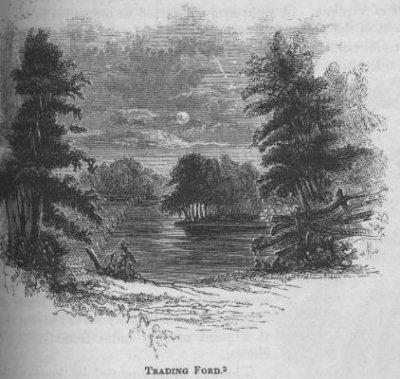
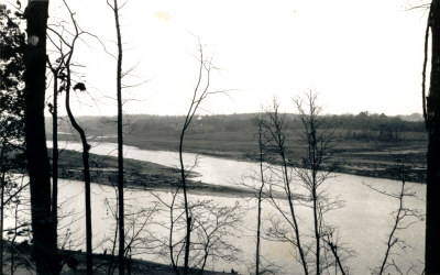
The Trading Ford in 1849
''2 This view of the Trading Ford, where Greene, with Morgan and his light troops, crossed the Yadkin, is from the east side of the river. It is just at the foot of an island, about a mile and a half below the great bridge on the road to Salisbury. The river is usually fordable between the island and the stakes seen in the picture; below that point the water is deep. I made this sketch just at dawn on a cold frosty morning (January 5, 1849), the moon shining brightly in the west, and the enarer stars glittering in profusion in the deep sky above.''
-- Benson J. Lossing, The Pictorial Field-Book of the Revolution,
Vol. II (New York: Harper & Brothers, 1852), p. 601
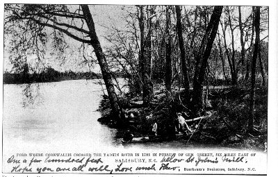
The Trading Ford c. 1900
Theo Buerbaum postcard from The Postcard History Series: Salisbury
and Rowan County, by Susan Goodman Sides.
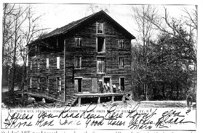
St. John's Mill c. 1900
St. John's Mill was built near the Trading Ford before the Civil War
and burned in 1913. Theo Buerbaum postcard from The Postcard History
Series: Salisbury and Rowan County, by Susan Goodman Sides.
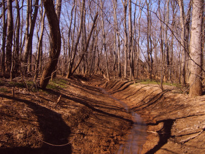
The
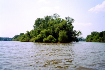
Trading Ford in 1932
The Trading Ford crossed the Yadkin River just below the tip of the Big Island. Photo by William Kizziah.
Wagon roads which carried our ancestors converge at the Trading Ford